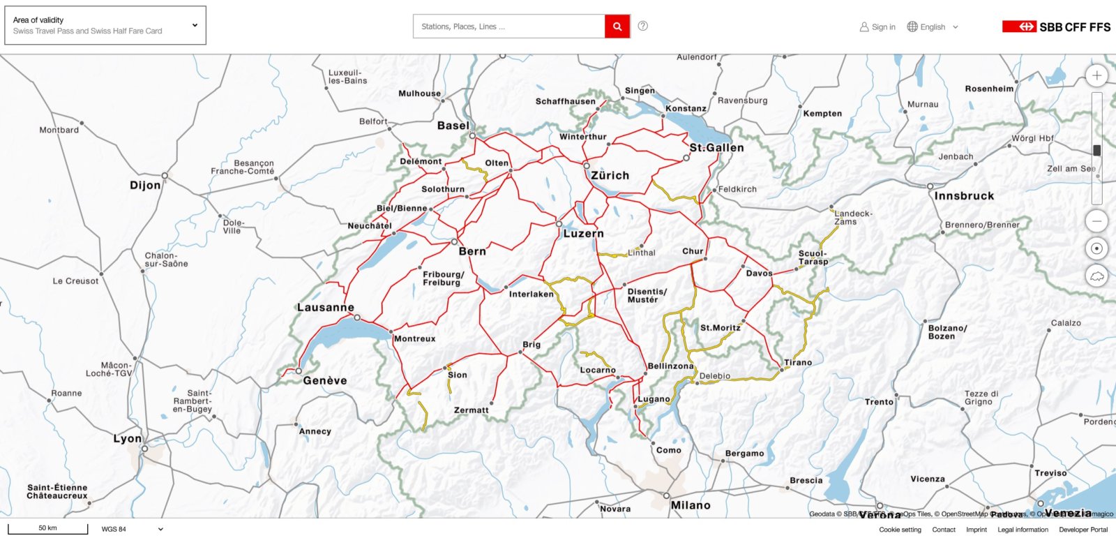
Are you ready to plan your Switzerland trip like a pro with the latest Switzerland train map? Find detailed information on train routes and stations, and plan your journey with ease. Whether you're a local or a visitor, our map is the perfect tool for planning your next train trip in Switzerland.
The official Swiss train map is also known as the Swiss network map. It is updated annually by Swiss Federal Railways and is the most comprehensive overview of the train network in Switzerland.
What’s included on the train map of Switzerland?
The Switzerland train map displays the entire train system of Switzerland, including all major and minor train routes, mountain railway lines, train stations, and connections between those stations. Despite being a rail map of Switzerland, it even includes boat lines.


Switzerland’s dense public transport system is operated by various railway companies operating in different regions. Luckily, these individual players have long synchronized their schedules, allowing trains to run efficiently across the country.
The official Swiss train map integrates the various train companies, including the Swiss Federal Railways (SBB), the Matterhorn Gotthard Bahn (MGB), and the Rhaetian Railway (RhB), among others.
The rail map of Switzerland is divided into three main regions:
- The German-speaking region, which includes Zurich, Bern, and Basel.
- The French-speaking region, which includes Geneva, Lausanne, and Montreux.
- The Italian-speaking region, which includes Lugano and Locarno.
And for ease of use, the map of Switzerland has been visually isolated from neighboring countries, putting all the focus on the train lines operating within Switzerland.
The Switzerland train map is available digitally or in print.
Printed Switzerland Train Map
Traditionally, the official SBB network map has been printed and published in various outlets. For instance, each train wagon features this map in the entryways, allowing travelers to look up possible connections quickly.
The official Switzerland train map's printed edition is updated annually and can be ordered online. Other printed versions of the map also exist, some of which are available at the counters of major train stations.
Swiss Railway Map PDF
Nowadays, it has become more common for travel planners to look up the Swiss train map online. The digital Swiss rail map covers the same level of detail as the printed edition - and then some.
In addition to standard layers, such as for GA/Half Fare coverage, various other layers exist. In 2023, a new layer was added, showing all the night train connections to and from Switzerland.
Here is the direct link to the digital Swiss rail map. Alternatively, download a PDF version.
And finally, the free SBB Mobile app includes the same digital map. This real-time map allows you to see nearby services and stations, pick up information about delays, plan trips, or simply zoom around and get inspired by all the possibilities.
Why the legendary Switzerland train map evokes wanderlust.
As anyone who has assembled a rail itinerary in Switzerland would attest, this map is an essential planning tool. That’s because, arguably, a minor disadvantage of using digital travel planners is that distances from point A to point B are not always apparent - just the time it takes to get there.
On the other hand, this time-proven map unlocks the full potential of Switzerland’s train system by showcasing the sheer number of connections possible. And is there a more wanderlust-evoking tool than a physical map waiting to be explored? We don’t think so.

Are you looking for the Swiss Travel Pass map?
Every year, a special edition of the Swiss rail map with the exact coverage area of the Swiss Travel Pass is published. The printed version of the area of validity map is freely available in various languages at counters in Swiss railway stations.
More effectively, you can quickly look up the Swiss Travel Pass coverage area in granular detail by activating the digital Swiss railway map layer.
Here is the link to the digital Swiss Travel Pass area of validity map. Alternatively, download a PDF version for printing or viewing while traveling.


Add comment