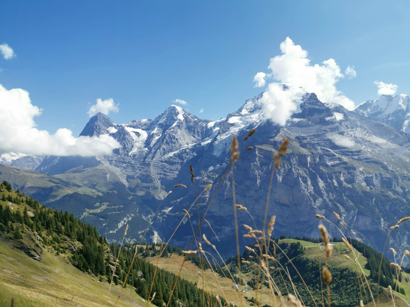
In the name of journalism, I’ve spent lots of time hiking across Switzerland. And let me tell you: there’s nothing like standing on a mountain pass, surrounded by jagged peaks that pierce the sky, knowing you got there on your own two feet.
If you’re searching for the best Swiss Alps hiking trails, you’re in the right place. These routes offer jaw-dropping scenery, accessible trailheads, and experiences for every skill level. And best of all, my tips and recommendations.
Most people visit Switzerland and never leave the tourist traps. They take the same Instagram photos as everyone else, eat overpriced fondue, and leave thinking they’ve “done” Switzerland.
Many internationals who move here never venture out of their comfort zone. At Newly Swissed, we think the key to truly experiencing Switzerland is to pick a different hiking trail every week…
But the real Switzerland is on the trails.
So, here are the 7 trails that will hopefully transform your perspective on the Swiss Alps – and might even leave you breathless!
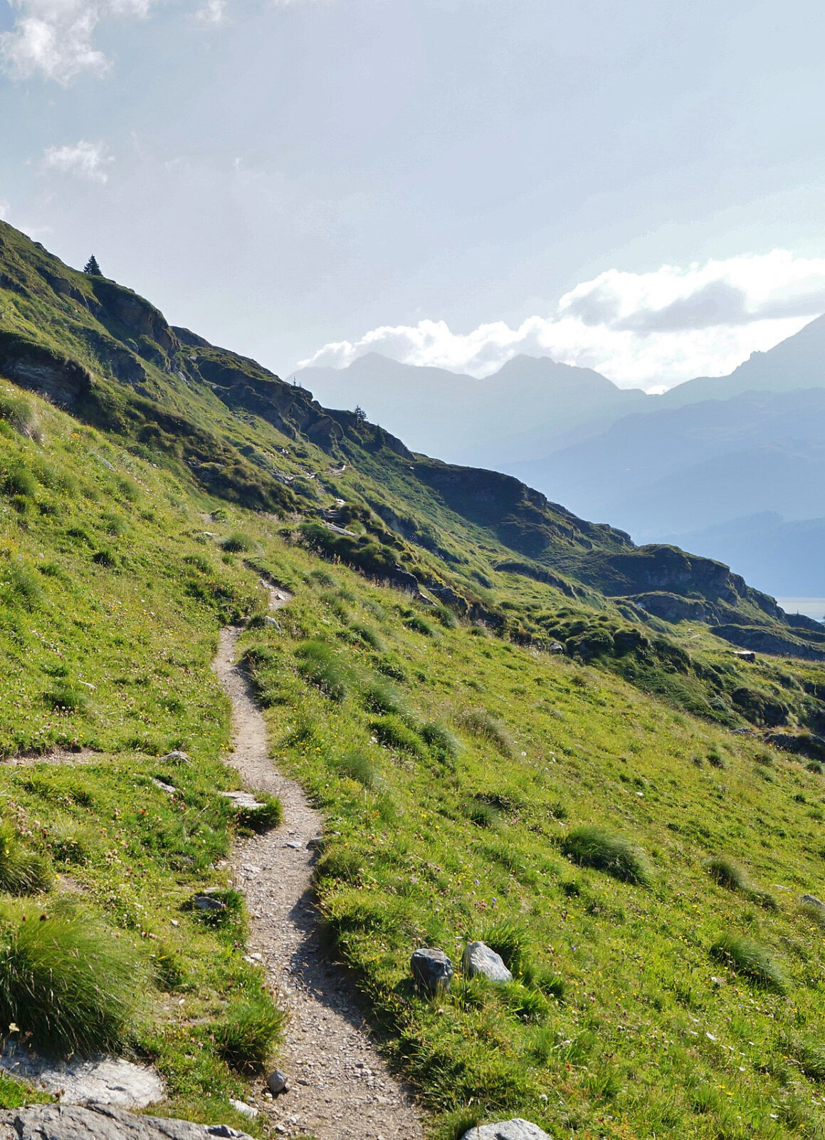
Aletsch Panoramaweg
Walking Beside Giants
TL;DR: Take a train to Blatten-Belalp, then ride the cable car to the trailhead. The route ends at Bellwald, where you can catch a train back. This 30 km trail is ideal from July to September and takes about 9 hours, done over 3 days.
Difficulty: Medium technical and physical requirements.
This Swiss Alps hiking trail runs alongside the Great Aletsch Glacier – 23 kilometers of ancient ice that’s been carving this valley for millennia. You’ll be walking right next to the longest glacier in the Alps, which is an awe-inspiring experience. Perched high above the Great Aletsch Glacier, the panoramic terrace at Hotel Belalp on the Aletschbord gives you front-row seats to the glacier’s lower reaches.
Also, you will encounter another glacier called Fiescher Glacier, which is 14 kilometers in length. The Burghütte sits tucked into wild alpine scenery, offering a classic spot to take in the sheer scale of this icy giant.
Between Belalp and Riederalp, you’ll cross an epic 124-meter suspension bridge over a gorge. And you’ll walk through forests of Swiss stone pines that have stood for centuries, and witness a landscape so spectacular that UNESCO designated it a World Heritage Site.
Chamonix to Zermatt Haute Route
The Ultimate Alpine Trek
TL;DR: Start in Chamonix, France, and end in Zermatt, Switzerland. This challenging 180 km trail takes 10 to 14 days and is best hiked from mid-July to mid-September. Requires a good fitness level and some experience with hiking.
This is the Swiss Alps hiking trail serious hikers dream about. 180 kilometers connecting Mont Blanc to the Matterhorn – two of the most iconic mountains in the world.
It will literally take you 10 to 14 days. You’ll cross high mountain passes, sleep in remote huts, and wake up to views that make you question whether you’re still on Earth. This isn’t a trail for beginners – you need to be fit and prepared for long days. And don’t forget that you’ll be carrying your own supplies.
At the end of your trek, once you’ve reached Mont Blanc, take a train from Chamonix to Zermatt to see the majestic Matterhorn (4 h 20 m with three transfers).
But here’s what most guides won’t tell you: the physical challenge isn’t what makes this exhaustive trail so special. It’s the transformation that happens when you spend two weeks moving through the mountains, carrying everything you need on your back, far from the distractions of modern life. I have yet to conquer this, but it’s somewhere on my bucket list…
Mont Blanc Trails
Three Countries, One Mountain
TL;DR: Access varies depending on which section you’re hiking, from a full circuit to a trail for less experienced hikers. The best season is June to September. Public transport options are available from major towns in France, Switzerland, and Italy.
Mont Blanc stands 4,810 meters tall; it’s the highest peak in Western Europe. The trails circling it take you through France, Switzerland, and Italy, each offering a different perspective on this massive mountain.
You have options here:
- The Full Circuit takes 10 days and challenges even experienced hikers
- The Highlights Route gives you the best views in 7 to 8 days
- The Rambler Hike offers an easier experience for those with less experience
What makes these trails special is the cultural journey – three countries, three cuisines, three approaches to mountain life – all while circling one of the most impressive mountains on the planet.
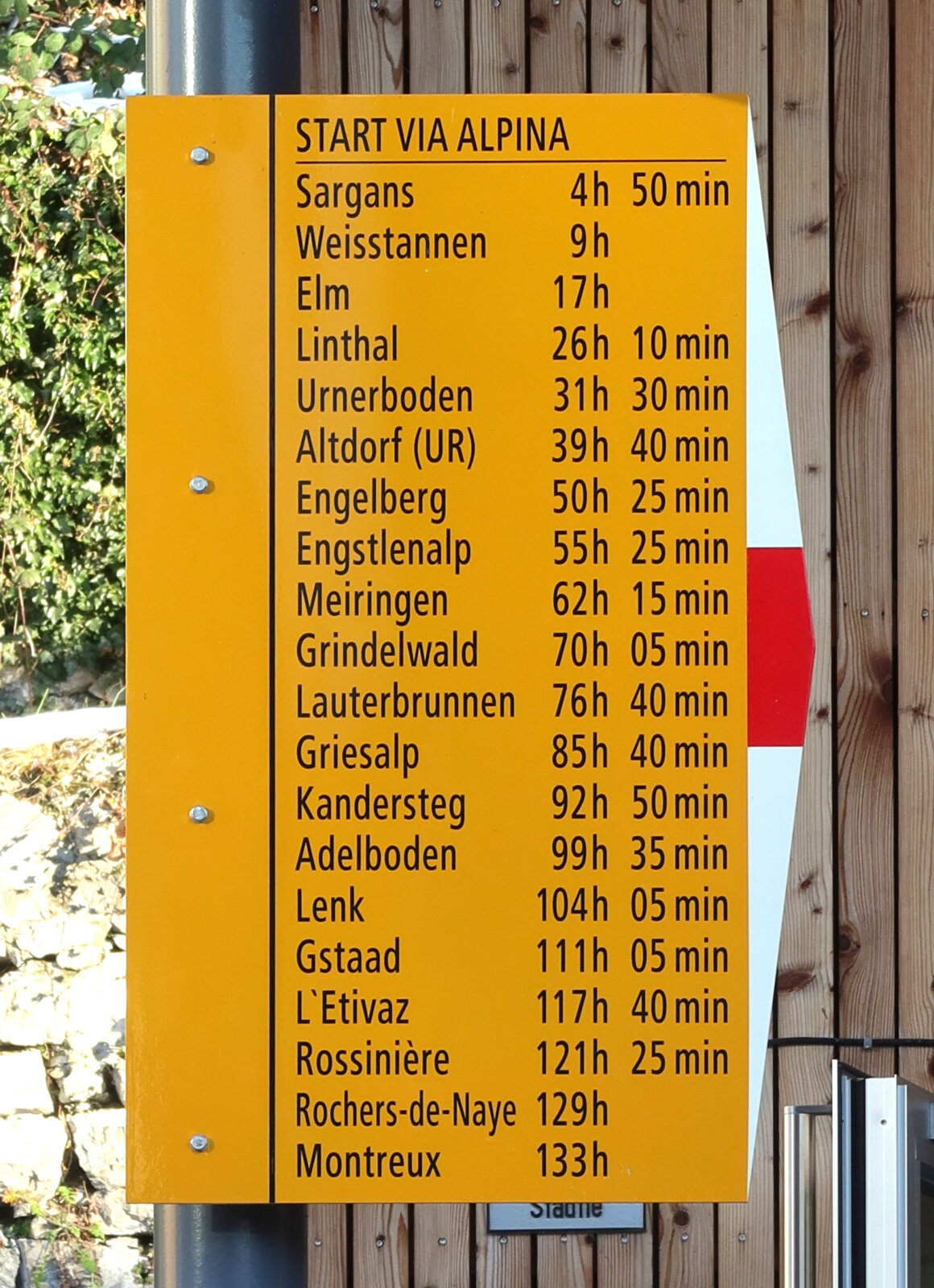
Via Alpina
Switzerland’s Signature Trail
TL;DR: This 390 km trail crosses Switzerland from east to west, covering 14 alpine passes. Start in Sargans (at the Liechtenstein border) and end in Montreux (Lake Geneva). Takes 18 to 20 days for the complete Swiss section. Accessible by train at multiple points along the route. The best season is mid-June to mid-September.
Difficulty: Moderate to challenging.
This is Switzerland’s National Route 1 – a 390-kilometer journey across the country from east to west, crossing 14 mountain passes along the way. The highest point is Hohturli Pass at 2778 meters.
The complete Swiss section takes 18 to 20 days, but you can tackle individual sections if you don’t have three weeks to spare. There’s also a luggage transport service, so you won’t have to worry about carrying your belongings.
This trail gives you the full Swiss experience – from the eastern regions near Liechtenstein to the shores of Lake Geneva in the west. You’ll pass through traditional villages where farming practices haven’t changed for generations, and witness the diversity of Swiss landscapes in a way that’s impossible by car or train.
Highlights along Via Alpina, and more information
Vier-Seen-Wanderung
The Four Lakes Wonder
TL;DR: Take a train to Engelberg, then ride the Titlis gondola to Trübsee lake, followed by a chair lift to Jochpass where the hiking begins. This moderate 11.3 km trail takes about 3.5 hours and ends at Melchsee-Frutt. Best hiked from July to mid-October.
Difficulty: Suitable for average hikers with some experience.
Not every great trail requires weeks of commitment. This 11.3-kilometer route takes you past four stunning alpine lakes: Trübsee, Engstlensee, Tannensee, and Melchsee.
I’m seriously considering hiking this trail with my dad this summer. Thanks to the gondola to Trübsee and the chair lift to Jochpass, the trailhead is very accessible. This is where the 3.5-hour hiking begins.
The four lakes are so clear that you can see straight to the bottom. In summer, locals swim in Engstlensee and Melchsee. Join them for a refreshing dip if you’re brave enough to handle the freezing lake temperatures… Engelberg also offers plenty of hotels, so you could embed this hike in a nice weekend getaway.
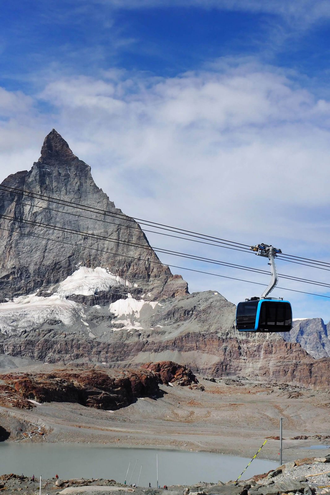
Matterhorn Glacier Trail
Face to Face With an Icon
TL;DR: Take a train to Zermatt, then either walk 20 minutes or take the free bus to the cable cars (with a valid ticket). Ride up to Trockener Steg station to start the trail. This moderate 6.3 km trail takes 1.5 to 2 hours with minimal elevation gain. Best hiked in the summer months.
For me, the Matterhorn isn’t just any mountain – it’s the mountain. It’s the peak that appears on Toblerone chocolate bars anywhere in the world. I don’t know how many hours and days I’ve marveled at the Matterhorn in Zermatt…
This relatively short trail (6.3 kilometers) takes you along the east flank of the Matterhorn, close enough to see climbers making their way up the face. You’ll walk past alpine lakes that reflect the perfect pyramid shape of the Matterhorn. And you’ll get to witness geological features created by retreating glaciers.
This Swiss Alps hiking trail starts at the Trockener Steg station and follows an easy grade with minimal elevation gain. It’s the perfect introduction to alpine hiking with maximum visual impact.
External Link: Matterhorn Glacier Trail to Schwarzsee – Swiss Family Fun
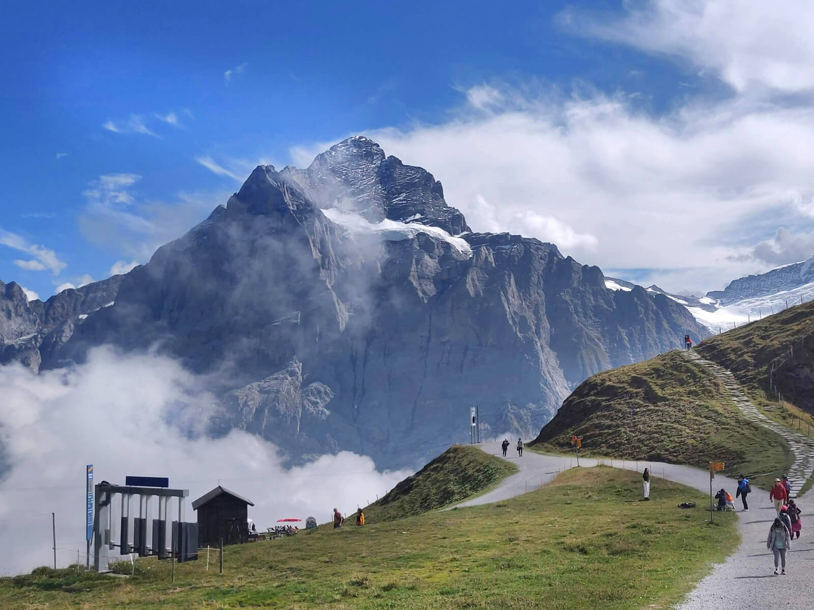
Eiger Trail
In the Shadow of the North Face
TL;DR: Take a train to Grindelwald, then ride the Eiger Express gondola (20 minutes) from Grindelwald Terminal to Eigergletscher station. This easy-to-moderate 6 km trail takes about 2 hours, mostly downhill. At the end, take the mountain train from Alpiglen back to Grindelwald. Best hiked from July to October.
The north face of the Eiger impresses me every single time. It actually has a dark nickname among climbers: Murder Wall. The 7.25-kilometer trail I describe here takes you directly beneath this legendary climbing route…
You’ll start at Eigergletscher station and follow a mostly downhill path to Alpiglen, with the massive north face looming above you the entire way. The trail passes the exact spots where famous climbing expeditions began their ascents, some successful, others tragic.
Insider tip: Before descending back to Grindelwald, treat yourself to a hearty Swiss dish (or a refreshing Rivella) at the Alpiglen mountain restaurant there.
When to Go: Timing Is Everything
Switzerland isn’t cheap. If you’re investing in this trip, you need to time it right:
- June: Early season. Some high passes may still have snow, fewer crowds, and alpine flowers beginning to bloom.
- July to August: Peak season. All trails open, warmest weather, most crowded, most expensive.
- September: Late season. Excellent conditions, fewer crowds, cooler temperatures, shorter days.
- October: Fall colors, much cooler, higher trails may have early snow, many mountain huts begin to close. Still possible for lower altitude hikes, but the weather becomes more unpredictable.
For the perfect balance of good weather, open trails, and manageable crowds, aim for early September. I’ve had some of my most memorable hiking weekends in September, such as in Grindelwald or Valais (Brig or Zermatt).
The Truth About Hiking in Switzerland
Here’s what most travel blogs won’t tell you: Switzerland will break your budget. A Swiss Travel Pass costs between 232 to 429 Swiss francs for three to eight days. Without the pass, a round-trip gondola ride might cost 60 francs. And a simple meal in a mountain restaurant will set you back 20 to 40 francs…
Maybe I’m biased, but I’ll say that every franc is worth it.
I always tell people that in Switzerland, nature starts right outside your hotel, and you’ll never be far from a yellow trail mark to start hiking.
If you decide to do a multi-day hike, you can stay at one of the many SAC mountain huts. These official shelters provide comfortable beds and hot meals along multi-day routes. You’ll pay between 60 to 120 francs per night, including dinner and breakfast. Again, it’s not cheap, but the experience of watching the sunset from a hut perched on a mountain ridge is priceless.
The mountains don’t care how much money you spent to reach them. They don’t care about your social media following or your job title. They simply stand, massive and indifferent, offering perspective on what truly matters.
The trails are waiting. Your boots are ready. The only question is: which path will you choose?